Tectonic faults are fractures in the Earth's crust where there is relative displacement of rocks on either side of the fracture. These geological structures are responsible for much of the seismic activity on the planet, as the release of accumulated energy along the faults generates earthquakes. The region of Puerto Vallarta, Jalisco, is located in a geologically active area due to the proximity of a major tectonic fault.
Mexico lies in one of the most complex tectonic zones in the world, where several tectonic plates converge, including the Cocos Plate, the Pacific Plate, and the North American Plate. This convergence is responsible for the high seismicity in the country, particularly along the Pacific coast. Puerto Vallarta, being located on Mexico's western coast, is part of this tectonic dynamic.

The fault that culminates in the Puerto Vallarta area is part of the fault system that borders the Pacific coast. This system includes the famous San Andreas Fault in California, extending south through the Gulf of California and affecting areas such as Bahía de Banderas, where Puerto Vallarta is located. The fault in this region is known for its seismic activity and its influence on the terrain's morphology.
The fault in Puerto Vallarta is a transform fault, which means that the tectonic plates slide laterally against each other. This type of fault is less prone to generating large earthquakes like those associated with subduction faults, but it can still produce significant seismic movements. The interaction between the Pacific Plate and the North American Plate in this region generates constant tension in the Earth's crust.
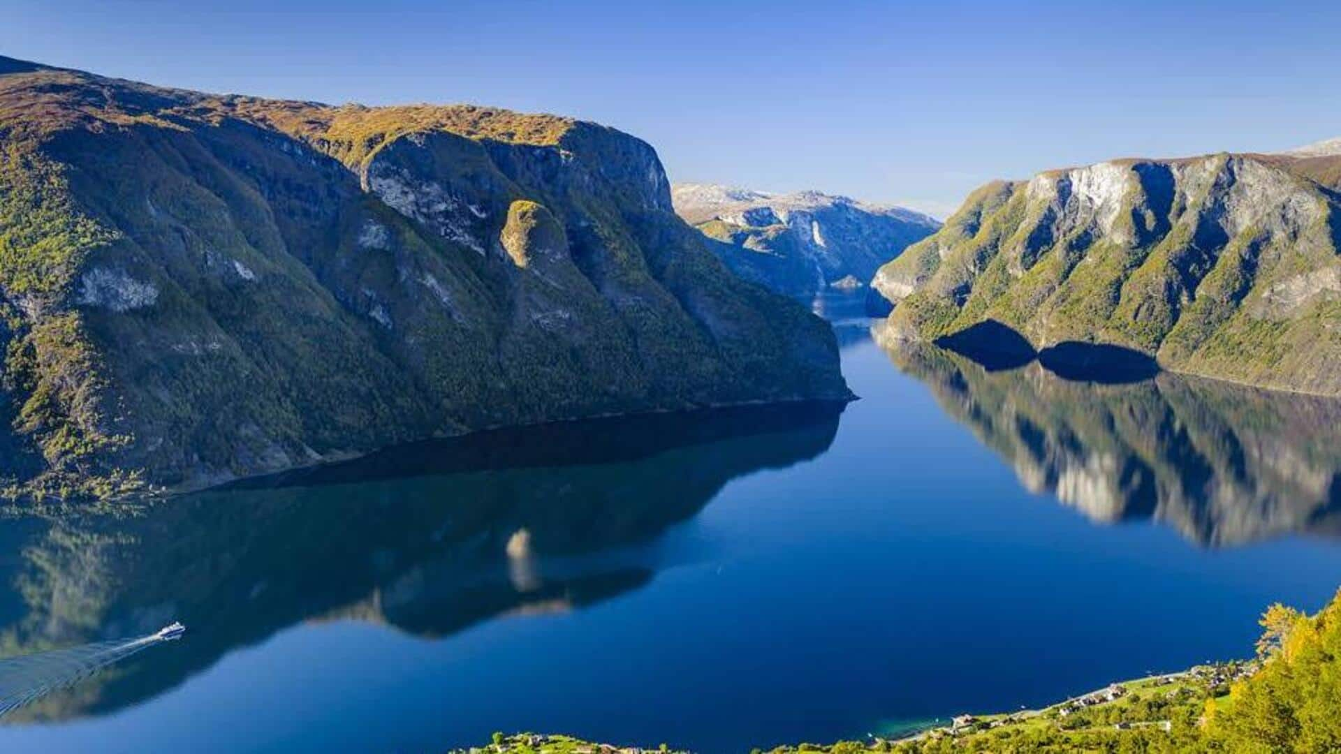
The formation of Bahía de Banderas, one of the largest and deepest bays in Mexico, is directly related to tectonic activity. This bay is an example of a tectonic basin, created by the sinking of a block of the Earth's crust along the fault. The fault has shaped the region's topography, creating a mountainous terrain that plunges abruptly into the ocean.
Puerto Vallarta, although not as seismically active as other regions of Mexico, occasionally experiences tremors due to the proximity of the fault. These seismic movements, though generally of low magnitude, are a constant reminder of the energy accumulated in the fault. The region's inhabitants are familiar with the possibility of earthquakes, although the city is equipped with infrastructure prepared to handle larger events.
The presence of a tectonic fault near Puerto Vallarta necessitates constant preparedness for potential earthquakes. Local authorities have implemented prevention measures and rapid response protocols to minimize risks. Additionally, the local community actively participates in earthquake drills, and newer buildings are designed with anti-seismic standards.
Tourism is one of the main economic activities in Puerto Vallarta. The presence of a tectonic fault might seem like a threat to the region's stability; however, tourism has remained robust. Tourists, attracted by the natural beauty of Bahía de Banderas and the surrounding mountains, are rarely deterred by tectonic activity, largely due to the safety measures in place.
Tectonic activity has played a crucial role in creating the varied landscapes that characterize Puerto Vallarta. The rugged mountains, deep valleys, and unique biodiversity of the region are partly the result of fault activity. The combination of elevated terrains and coastal areas has created diverse habitats that host rich flora and fauna, both terrestrial and marine.
Given the importance of the tectonic fault in Puerto Vallarta, the region is the subject of numerous geological and seismological studies. Mexican and international institutions collaborate in monitoring seismic activity and researching the tectonic dynamics in the area. These studies not only help to better understand the risks but also contribute to the development of improved disaster mitigation strategies.
Tectonic activity is an ongoing process, and while earthquakes cannot be predicted with precision, the fault in Puerto Vallarta will remain a potential source of seismic events. In the long term, it is likely that the region will continue to experience changes in its geography due to tectonic activity. Understanding these processes is essential for planning urban development and infrastructure in a way that minimizes risks.
.