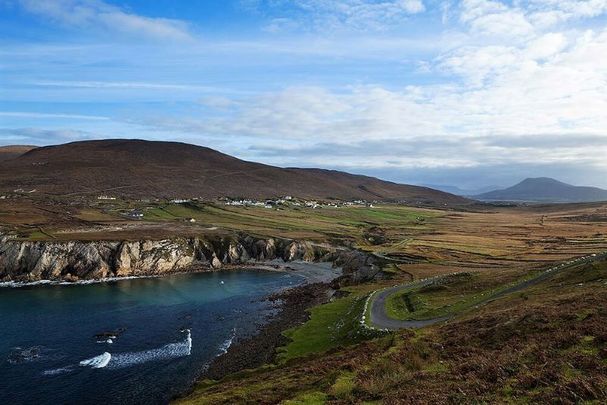
Saturday, August 24, 2024 The Hawaii Tourism Authority reassured visitors that it’s still safe to travel to the islands, while advising them to delay outdoor activities for the time being. Tropical Storm Hone is forecasted to bring strong gusts of wind and significant rainfall to the southern parts of Hawaii this weekend. The approaching storm poses a serious threat of flooding and wind damage, particularly on the Big Island.
Residents and visitors in the region should prepare for potentially hazardous conditions as the storm advances. The combination of heavy rain and high winds may lead to disruptions and dangerous situations, especially in areas prone to flooding. In response to the storm’s projected path, the National Weather Service has issued a tropical storm warning specifically for Hawaii County, which encompasses the entire Big Island.

This warning indicates that tropical storm conditions are expected, with winds capable of causing damage and heavy rains that could result in flash flooding. The residents of the Big Island are urged to take necessary precautions to safeguard their properties and ensure their safety during the storm’s impact. In addition to the tropical storm warning, a red flag warning has been declared for the leeward, or drier, sides of all the Hawaiian islands.
This warning highlights the increased risk of wildfires, as the storm’s winds could spread any existing fires rapidly. The dry conditions on these sides of the islands make them particularly vulnerable, and the combination of wind and dry vegetation could lead to devastating wildfires. Authorities are urging people to avoid activities that could inadvertently ignite fires and to be vigilant during this critical period.
The convergence of these weather threats underscores the need for heightened awareness and preparedness across the islands. While the tropical storm brings the potential for wind and water damage on the Big Island, the drier regions of the other islands face the contrasting danger of wildfires. Residents and visitors alike are encouraged to stay informed about the storm’s progress and adhere to safety recommendations from local authorities to minimize the risks posed by Tropical Storm Hone.
Hone, a name that translates to “sweet and soft” in Hawaiian, is currently a tropical disturbance that is anticipated to gain strength over the coming days. According to the National Weather Service, Hone is likely to develop into a robust tropical storm as it moves south of the Hawaiian Islands on Saturday and Sunday. The storm’s gradual intensification will be closely monitored as it approaches, with forecasters expecting it to bring potentially significant weather impacts to the region.
The storm is projected to escalate further, potentially reaching Category 1 hurricane status by Sunday. However, meteorologist Laura Farris from the weather service in Honolulu noted that by the time Hone achieves this level of intensity, it will likely have already moved past the Big Island. This brief period as a hurricane is expected to last only about 12 hours, minimizing the direct impact on the islands.
Nonetheless, the situation remains fluid, and residents and visitors are advised to stay informed about any changes in the storm’s path or strength. In light of the impending storm, the Hawaii Tourism Authority has reassured travelers that it is still safe to visit the islands. However, they strongly advise postponing any planned outdoor activities until the weather stabilizes.
The agency emphasized that while the islands remain accessible and safe for travel, it is prudent to take precautions and avoid unnecessary risks, particularly in areas that may be more exposed to the storm’s effects. As Hone continues its approach, both residents and tourists are urged to stay updated on weather conditions and heed any advisories or warnings issued by local authorities. The situation underscores the importance of preparedness and flexibility in the face of nature’s unpredictable forces, ensuring that everyone remains safe during this period of heightened weather activity.
Late Friday, Hone was positioned approximately 425 miles (685 kilometers) east-southeast of Hilo and around 640 miles (1,025 kilometers) east-southeast of Honolulu, as it continued its approach towards the Hawaiian Islands. Forecasters predict that the eastern and southeastern regions of the Big Island could experience significant rainfall, with totals ranging from 5 to 10 inches (11 to 25 centimeters). Along with the heavy rain, sustained winds are expected to reach speeds of 20 to 40 mph (32 to 64 kph), with gusts potentially reaching up to 60 mph (97 kph), posing a risk of localized damage and disruptions.
In addition to the storm’s direct impact, the dry air mass located to the north of Hone is anticipated to bring arid conditions across the Hawaiian archipelago on Saturday. This dry air, when combined with the strong winds generated by the storm, will elevate the risk of wildfires across the islands. The U.
S. Drought Monitor has already noted that much of the state is either abnormally dry or experiencing drought conditions, further exacerbating the wildfire threat. As Hone continues its trajectory, residents and authorities remain vigilant, particularly in light of the heightened fire risks and the potential for significant weather impacts.
The combination of these factors underscores the need for continued caution and preparedness across the Hawaiian Islands. The National Weather Service has issued a red flag warning that will be in effect from 10 a.m.
to 6 p.m. on Saturday.
This alert is triggered when a combination of high temperatures, extremely low humidity, and increased wind speeds significantly heighten the risk of wildfires. The devastating wildfire that swept through the historic town of Lahaina on August 8, 2023, marked the deadliest wildfire in the U.S.
in over a century. Fueled by powerful winds, partially driven by a hurricane passing south of Hawaii, the fire claimed the lives of 102 people. The rapid spread of the flames was exacerbated by dry, overgrown grasses and persistent drought conditions.
Meanwhile, to the east of Hone, Hurricane Gilma was making its way across the Pacific as a Category 2 storm. Forecasters expect Gilma to weaken in the coming days as it moves over cooler waters and encounters drier air, eventually downgrading to a tropical depression by Wednesday..