Summary AgEagle drones feature unique cameras, including 3D mapping. The Duet T camera can perform thermal and color mapping simultaneously. The AgEagle drone family offers drones for mapping, tactical use, and public safety, with 90-min flight time.
Recently, Simple Flying was honored to interview AgEagle Aerial Systems Inc. CEO Bill Irby about his drone manufacturing company's unique capabilities. Unlike General Atomics’ larger reconnaissance drones , the 90-minute endurance drones can be hauled in a backpack and operated with a day of training by a single operator.

Also, unlike DJI’s consumer drones, AgEagle’s drones come with more endurance and multiple camera options – including a 3D mapping option. AgEagle offers unique cameras, including 3d mapping The top feature that AgEagle drones have to offer is 3D mapping. According to CEO Irby, watching the 3d mapping camera in operation shared that, “When they landed, within about a minute, about 60 seconds, they produced an entire 3d map, and you could rotate it around and look at every angle.
” This is incredibly helpful for military and first responder purposes for inserting personnel into a dangerous situation. Or, for example, Opole, Poland, where a national 12 points/m2 lidar dataset was found to be insufficient. So the Opole officials decided to use an eBee X fixed-wring drone with a special camera.
Quoting from the AgEagle website, “To map buildings and vertical surfaces in the city’s urban areas they use the eBee series S.O.D.
A. 3D camera , a photogrammetry sensor optimised for 3D mapping applications. The camera changes orientation during flight to capture three images (2 oblique, 1 nadir), and so produces a much wider field of view.
Since 2D imagery is sufficient for the city’s surrounding and rural areas, the team uses the eBee series Aeria X camera which produces high-resolution, accurate data with its 24 MP sensor and optimised exposure time for operations in most light conditions.” But 3d mapping is not all that AgEagle drones do. AgEagle drones also pack other cameras.
Using drones as an infrared camera platform AgEagle also has the Duet T camera which can do thermal mapping alongside color mapping. According to AgEagle, the Duet T, “Is a 2-in-1 sensor. Includes a 20 MP high-resolution S.
O.D.A.
RGB camera and a built-in 640 x 512px FLIR sensor.” One can see some sample images below: Additionally, the camera can be used for animal management, irrigation planning, heat tracking and other environmental good works. The Duet T camera can be mounted on the eBee mapping drone, eBee TAC tactical mapping drone, and the eBee TAC public safety drone.
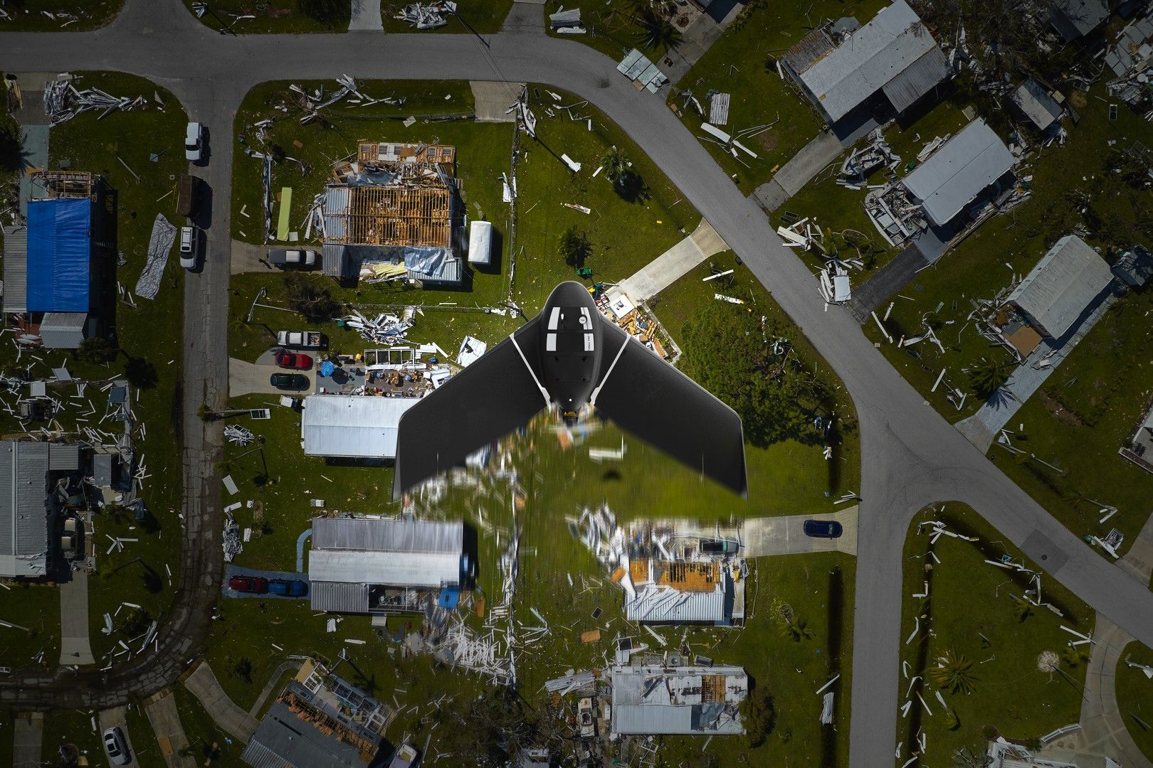
About the AgEagle drone family The AgEagle drone family is not just the eBee mapping drone, eBee TAC tactical mapping drone, and the eBee TAC public safety drone but also the eBee Vision. The eBee Vision, instead of doing mapping like the first three drones, provides real-time reconnaissance. Keep up with the latest Simple Flying coverage of military aviation here The eBee Vision can fly for 90 minutes, up to 12 miles (20 km), and can be deployed from a backpack in 3 minutes with a weight of 3.
5 pounds (1.6 kg). On the eBee Vision is a 32x zoom HD camera plus a 5x zoom thermal camera on a drone that can be remotely flown or fly a preprogrammed flight path.
To CEO Irby, the drone’s low noise would be much better than a police helicopter that let everybody know there was overhead surveillance. One can watch an online demo below: But there is also the eBee mapping drone which is the basic drone. The basic drone is cleared to conduct operations over people and has other certifications for civilian personal use.
Each drone comes with the ability to pack one of six cameras, two batteries, a drone backpack, some flight management software to preplan flights, a USB ground modem, spare propellers, and more. Plus there's the eBee TAC public safety drone optimized for first responders. The drone comes with easily swappable cameras and SD cards to help provide information for first responders to make better decisions to keep themselves and the public safe.
One can learn more via the brochure below: Ultimately, the eBee TAC tactical mapping drone also comes with advanced data links and low observable features like low acoustic and visual signatures at 300 m / 984 ft AGL The eBee TAC can also produce Military Grid Reference System (MGRS), the geocoordinate standard used by NATO. In other words, eBee TAC is optimized for militaries who want a soldier to be easily trained within a day to launch an aerial reconnaissance drone from a backpack in 3 minutes to fly 90 minutes before changing batteries. The eBee TAC is also approved by the Defense Innovation Unit (DIU) for procurement by the U.
S. Department of Defense (DoD) meaning the drone is safe and cleared for US servicemembers to purchase for their needs. Bottom line In closing, ultimately, CEO Irby wants to grow his drone industry with a unique product.
Irby wants more investors to help fund growing not just the production facilities for the drones but also the capabilities of eBee. At least unlike a traditional quadcopter drone, the eBee drones use a flying wing to stretch range and provide multiple camera options to provide mapping, thermal imagery, and real-time surveillance..