Vadodara: The marooning of parts of the city on the western side of the Vishwamitri river should not come as a surprise. Centuries ago, the residents of these areas seem to have understood the perils of staying there and had gradually shifted to the eastern parts of the city. In the last few decades, these areas on the western side of the river witnessed fast-paced growth that seems to have returned to haunt them now.
Akota and its surrounding areas like Old Padra Road, Mujmahuda, Jetalpur Road and others faced the first flooding since the time these areas witnessed development. Ankotakka, or present-day Akota, was the first settlement that gained prominence in the region and was a flourishing centre which had links even with the Romans. It is believed to have come up around 2,200 years back and developed into a prosperous town.

Vadpadrak, from which the city derives its name, was a mere suburb across the river which did not gain prominence till the end of the 11th century, says prominent archaeologist R N Mehta in his book ‘Vadodara – Ek Adhyayan’. The mention of Ankotakka at various places goes down significantly in the second half of the 11th century even as Vadpadrak, settled around the present Kothi area, started developing. “The residents started moving to Vadpadrak from Ankotakka or Akota which may have started dying gradually,” said architect and co-convenor of INTACH, Gujarat, Sanjiv Joshi.
Joshi observes that the Walled City was planned even far away from the river in the 16th century. “No major development came to the Kothi area for a long time till the British Residency building or Kothi building and other buildings came up much later,” he said. Even these buildings are at a height.
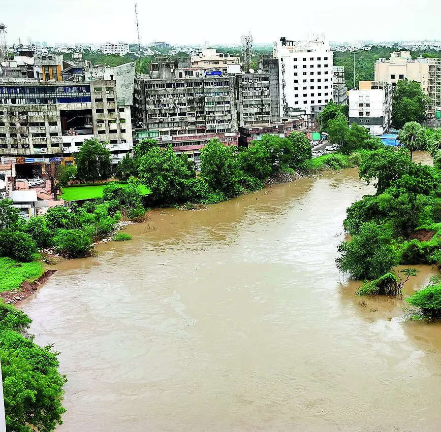
In the last few decades, settlements returned to the areas from where they had moved away and ended up getting submerged. Joshi said that the floods in the city are a man-made problem. “The Gaekwads also recognised the issue and most structures were constructed away from the river.
The Laxmi Vilas Palace’s side towards the river is an open space even as Kamatibaug is another example. It was ensured that there was space for the river if it swelled,” Joshi said. Joshi, who has studied the planning of the city in detail, said that if one were to look at the river today, one would find several red dots that obstructed its flow.
He observed that even the span of the river seemed to have been narrowed. “When we measured the damaged old pedestrian bridge across the river, we were surprised to note that it was 75m wide,” he said..